Geographic names
Nicholas Zharkikh
Shortened text of the section. Full text in ukrainian version
Consider the geographical names given in Rogozhsky chronicler (I repeat – only in part of the 1355 – 1374 years), and see what they say. For the less well-known names in the table are links to Wikipedia, unknown names marked with an asterisk (?).
Table contain 88 geographical names.

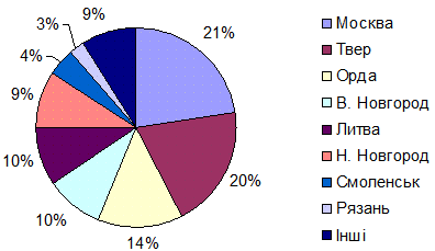
Distribution of names in Rogozhsky chronicler for principalities

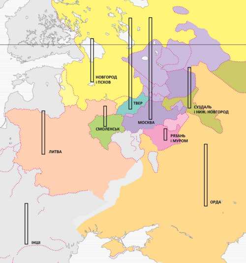
Schematic map distribution of names in Rogozhsky chronicler for principalities (drawing by Dmytro Vortman)
All names mentioned in this part of Rogozhsky chronicler can be divided into two groups. The first is the "external" names – 19 sites (22%), 136 mentions (23%). 78% of the objects and their references belongs to a rectangle that covers the Great Russian lands.
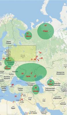
Overall schematic map of geographical names Rogozhsky chronicler
The numbers correspond to the numbering objects in the table
There are two names refer to the outer neighbors of Great Russia – Lithuania and the Horde (with 105 references, 18%). The name "Horde" have not a geographical but political importance. Horde – the center of political power. In the Horde Rogozhsky chronicler knows only 4 cities (Sarai – Bezdezh – Bulgar – Zhukotin).
The rest of the "external" names are referred to regions or the capital or patriarchates (Alexandria – Antioch – Jerusalem – Constantinople). There is no detailed topography of these lands in Rogozhsky chronicler.
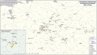
Schematic map of Great Russia geographical names in the Rogozhsky chronicler (drawing by Dmytro Vortman)
Arrows – military action (with the designation of years)
Quite a different situation with the name of Great Russia. There are no area names at all here, but it presents the names of cities, villages, and rivers (sometimes very small). The extreme points of the south-west are the Smolensk, Bryansk and Mstislavl. Rogozhsky chronicler did not know any objects further to the west and to the south, in the lands of modern Belarus and Ukraine. That we need to remember for the future.
Out of the total of the rectangle, which is limited in the north by Vologda, in the east – Kurmysh at Sura river, in the south –Novosil, and west – Izborsk, one can select the central part of the area of about the rectangle. This part is bounded on the north in Vesegonsk, in the east – Pereslavl-Zaleski, Lyubutsk (Kaluga) in the south and Rzhev in the west. The center of this smaller rectangle is in Konakovo on the Volga – just halfway from Tver to Moscow. This is a geographical area of competence Rogozhsky chronicler, and we see that it is here focused the principal amount of the military campaigns mentioned in Rogozhsky chronicler.
The conclusion from this analysis is simple – all the little-known or little understandable names in Rogozhsky chronicler are small objects from a later narrow area.
These names include Horvach (according Kuchkin, in the 16th century it was the name of territory between towns Mikulin and Pogoreloe Gorodische [Kuchkin V. A. Formation of the state territory in the North-Eastern Russia in the X – XIV centuries. – M.: Nauka, 1984, p. 148]), Rodnya (it is not "our" Rodnya at the confluence Ros to Dnieper, but the town of the same name on the Volga, above Staritsa ).
So, Blue Water that is and necessary to us, should be placed in the territory of the Tver principality.


